- TOP
- RESEARCH AND DEVELOPMENT
RESEARCH AND DEVELOPMENT
-
AI Technology Research for Environment and Social Infrastructure Management
Detecting troublesome and illegal activities in public spaces Public spaces such as rivers and parks are precious open spots where visitors can bask in rich natural surroundings and enjoy cultural landscapes. These familiar spots, however, are frequently locations for troublesome and illegal activities such as illegal dumping as well as illegal and thoughtless parking, leading to an increased workload for administrators who strive to improve and call attention to the situation. A solution to this problem is the development of AI-driven technology that can detect troublesome and illegal activities for sophisticated, labor-saving public space management. A demonstration experiment of a monitoring system equipped with this technology at riverside spaces showed that it could detect virtually all troublesome and illegal activities, suggesting that AI could be useful for sophisticated, labor-saving river management across the nation. Detecting natural and artificial anomalous phenomena In recent years flooding due to torrential rains has grown more severe and frequent, and water pollution due to chemical substances released from factories continues to occur. Infrastructure and facilities administrators monitor the situation using cameras, IoT sensors etc., to prevent such problems, however, continuous monitoring including on holidays and at night is necessary, which presents challenges such as allocation of personnel and appropriate monitoring methods. This research focuses on the development of AI-driven anomalous phenomena detection technology for streamlining infrastructure monitoring and facilities management. AI can detect anomalous phenomena such as river flooding, volcanic eruptions, and water pollution from images on CCTV cameras at offices and images on the web, etc., and then alert administrators. This system is expected to streamline infrastructure and facilities administrator monitoring tasks, contributing to labor saving. Utilization of the metaverse The metaverse, a virtual space through which visitors can move freely, is starting to be used not for video games or animation, but in business. In construction and civil engineering projects it is expected to serve as a consensus building tool that allows residents to experience and view buildings and other public facilities before they are constructed by building completed versions in the metaverse. In addition to the above tools, this research also focuses on developing technology for visualizing damage to river embankments and bridges in the metaverse. The technology converts aerial shots of river embankments and survey results to 3D point cloud data to automatically detect deformations by picking up terrain unevenness from its placement, then displaying it in the metaverse. Because it can automate inspection tasks that previously required a person to visually survey areas while walking, it is expected to prevent missed areas and contribute to sophistication of the maintenance field.
-
AI Technology Research for Traffic and Urban Infrastructure Management
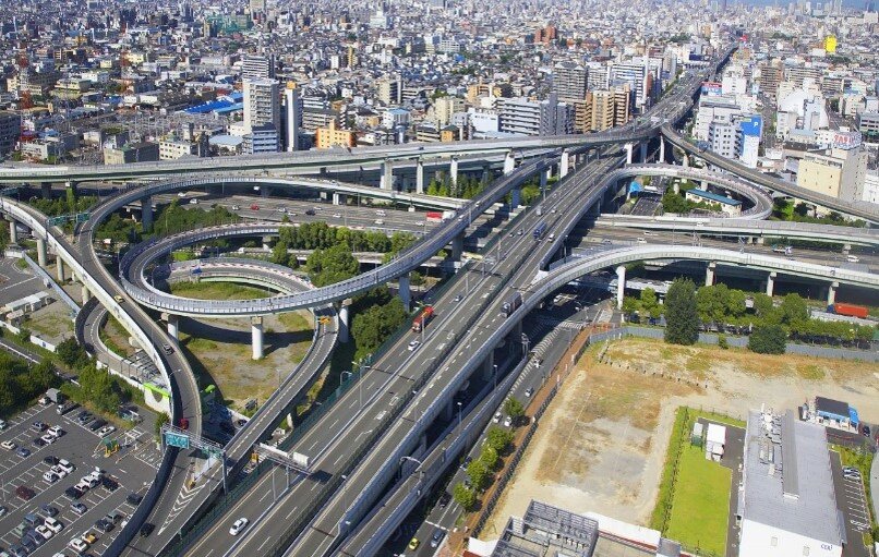
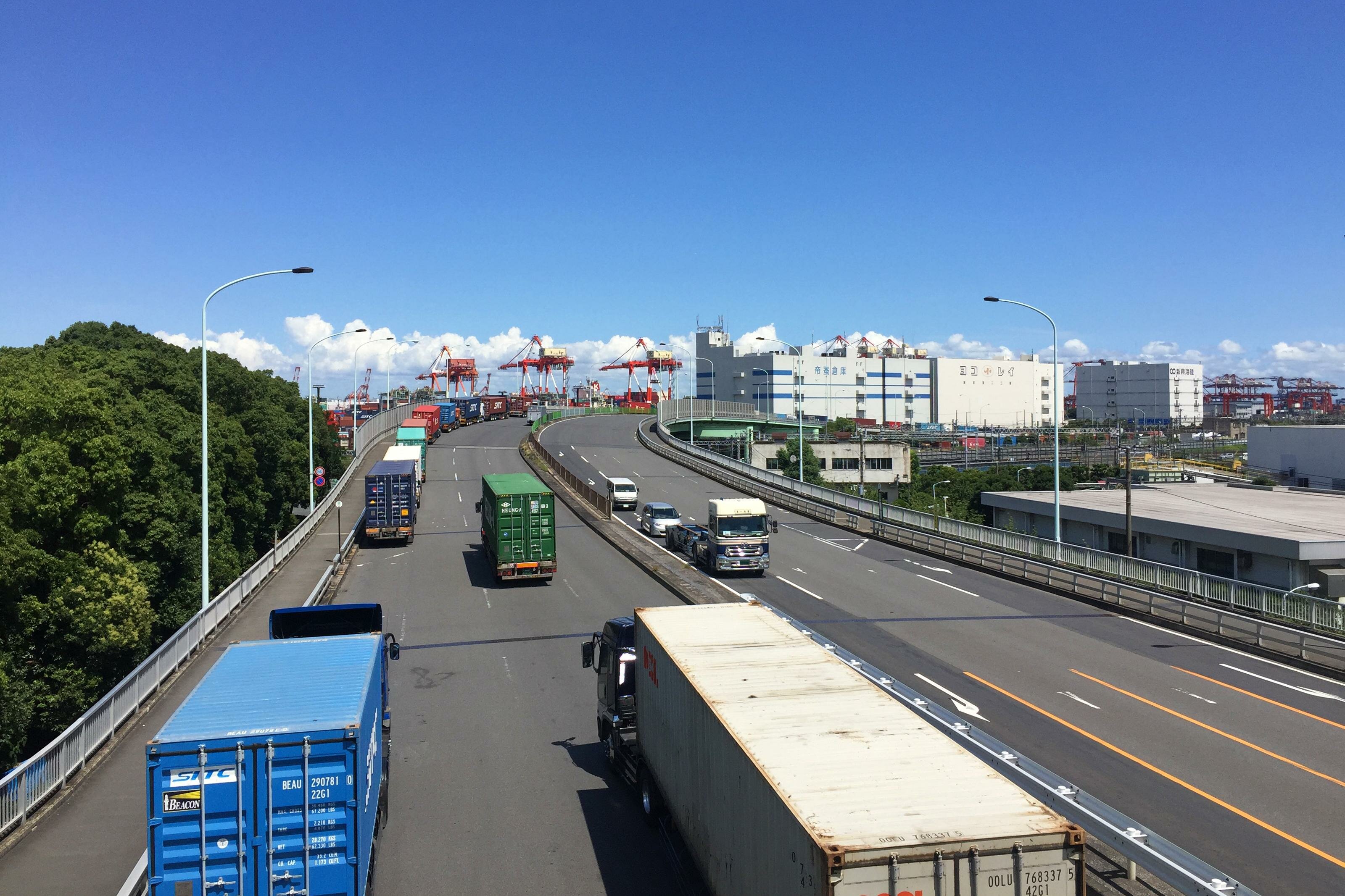
Real-time traffic jam forecasting using AI Estimates show that each person loses approximately 40 hours per year due to traffic jams. Congestion not only results in lost time, but various issues such as a decrease in comfortable road use, an increase in fuel consumption, and increased burden on the environment due to exhaust gases. One solution is to develop AI technology that forecasts traffic jam times several minutes to several hours in the future using information such as traffic volume and travel speed. The forecasts could then be provided to road administrators in real time to encourage detours and contribute to alleviating traffic jams. Identifying usage conditions in bus terminal spaces using AI Many people gather at bus terminals, including pedestrians, passengers, and visitors to commercial facilities. However, these useful spaces are not being efficiently utilized according to certain times, making it difficult to grasp conditions for intensive use. This research focuses on developing AI technology that efficiently grasps usage conditions in terminal spaces. The information can then be used to automatically identify low usage spaces and times, verifying possibilities for intensive use for more prosperous, smart urban development proposals. License plate detection and blurring Road facility management tasks are far ranging, including daily monitoring, maintenance, identification of and provision of information during emergency situations. On the other hand, a lack of personnel due to an aging population combined with a diminishing birth rate in recent years has increased the burden of such daily tasks for administrators. A solution for reducing and streamlining a staff workload is the development of AI technology that can read license plates from road administration camera footage. Also, to protect individuals’ personal information, technology is being developed to blur any information that can be used to identify them.
-

AI Technology Research for River and Sabo Infrastructure Management
Optimized dam operation using AI Dam operation must take into consideration the balance of flood control (preventing or mitigating disasters) and water utilization (use of stored water for power generation etc.). Operational methods in this regard generally use rainfall estimations to predict future river flow rates, then release water accordingly. However, rainfall estimation accuracy is imperfect, and predictions can be significantly off the mark. Trusting in such predictions when operating a dam is dangerous as doing so can trigger disasters downstream or result in a lack of stored water for power generation. This research aims to develop AI technology that minimizes losses by taking estimated rainfall precision into consideration. Dam anomaly detection All structures eventually deteriorate. Infrastructure is no exception. To ascertain whether structures are sound, a variety of data is collected from many types of infrastructure. Development of ICT in recent years has resulted in the collection of significantly more data, leading to an increase in accuracy. However, in many cases, the data is checked visually by a person to ascertain soundness and identify anomalies. This research uses collected data to develop AI technology that is capable of completely and quantitatively detecting anomalies that were previously only detectable via a visual inspection or according to worker experience. The technology is expected to be applied not only to dams, but various other infrastructure areas to streamline maintenance tasks. Automatic identification of Sabo facility deformation Conventionally, a visual inspection of Sabo facilities was required to identify deformations and assess soundness. However, such facilities are found in steep mountainous areas, making comprehensive, objective identification of deformations, and assessment of overall soundness difficult in terms of safety and efficiency. On the other hand, development of AI image analysis and UAV imaging related technologies has continued to progress in recent years. When considering the massive amount of inspection data being collected, it is important to appropriately combine these technologies to effectively promote maintenance via digital transformation (DX). This research focuses on developing AI technology capable of automatically identifying deformations in Sabo facilities. Continuous research in this area should enable more efficient inspections at such facilities through consideration of methods that have been incorporated into the erosion control facility inspection.
-
Social Implementation of a Laser Hammering System
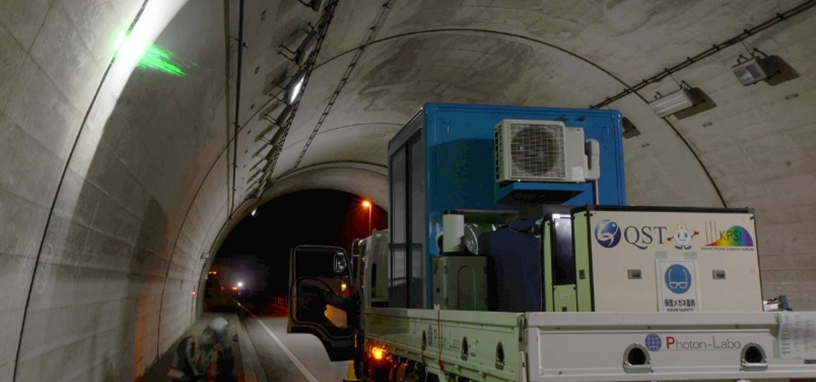
Robot inspection technology that does not rely on human hands Conventionally, tunnel inspection tasks have been handled via specialist engineers performing visual checks or hammering, requiring considerable time and effort accompanied by the danger of falls. There are also concerns over the lack of engineers qualified to perform hammering inspections, necessitating the social implementation of remote and contactless measurement technologies to support this work. To meet such needs, research and development of laser hammering technology is under way in preparation for full-scale social implementation. This technology uses a vibrational excitation laser to vibrate the lining concrete instead of using a hammer, and a vibration measurement laser to measure the vibrations instead of relying on an engineer’s ears, enabling remote digital hammering inspections. Ensuring safety and eliminating individual skill differences with remote digital hammering inspections The laser hammering system eliminates the need for engineers to perform hammering inspections in dangerous, high locations ensuring intrinsic safety while also doing away with skill level differences among individuals. Furthermore, using this system for measurements improves the diagnostic quality of concrete damage and creates quantitative records of tunnel health. These records can be compared against those from several years in the past, for example, to diagnose the level of degradation progression linked to concrete flaking. Continued record taking in this way can help identify quantitative changes over time such as internal damage and degradation progression, helping streamline and improve inspection and maintenance tasks. The laser hammering system was developed with a focus on tunnel lining concrete, however, applications for various types of infrastructure elements are moving forward with efforts to develop safe, reliable robot inspection equipment that does not rely on human hands.
-
RisKma (water-related disaster risk mapping system)
Real-time map information service predicting water-related disasters up to 36 hours in advance RisKma (water-related disaster risk mapping system) is an online service that predicts sudden, localized downpours and torrential rains, which have been occurring frequently in recent years, and sends out information on the risk of water-related disasters in real time. General users can also access the site through a browser to view information such as rainfall forecasts, flooding risks, and sudden, localized downpour (“guerrilla rainstorm”) forecasts displayed on a map, free of charge. At the current level of functionality, the system is able to offer rainfall distribution forecasts up to 36 hours in advance. In addition, cumulative rainfall distribution data is delivered every five minutes, allowing users to grasp the current situation in real time. The flood risk function provides information on the risk of flooding due to sudden downpours and a “virtual water surface map” that visualizes the potential for flooding in target areas based on the water level of the river. The flood risk forecast provides real-time analyses and forecasts of flood risk up to 60 minutes in advance on a 250m x 250m grid map of Japan that refreshes every five minutes. The virtual water surface map illustrates the height difference of the surface of a nearby river and ground level at any given location by extending the water surface across the map in real time. The “guerrilla rainstorm” forecast covers the Kanto, Hokuriku, and Chubu regions and displays information on torrential downpours for the next two to three hours. The system also provides an email alert service to notify users of this information when water-related disaster risks occur. The service provides users with real-time information on the risk of inland flooding and torrential downpours. Development of a river basin water cycle model and services for local governments and corporations We have developed a river basin water cycle model for the entire Shikoku region in western Japan, as well as a system that can provide drought forecasts up to one month in advance. The river basin water cycle model combines a distributed rainfall-runoff model with the UNSAF groundwater model. This enables the provision of information on drought risk. This model helps water resource managers to implement effective drought countermeasures. Currently, we are developing a system that will expand this platform to provide useful information for facility operations and river use during normal and drought conditions, as well as during floods. In addition, we are providing local governments and corporations with professional services on water-related disaster countermeasures for torrential rains, floods, and local runoff, as well as water-related disaster data through RisKma. The system can be customized with a wide range of functions to predict flood inundation areas, save office locations on the map, visualize the distribution of flood warnings by level, show landslide disaster warning areas, and communicate information in numeric data, among others.
-
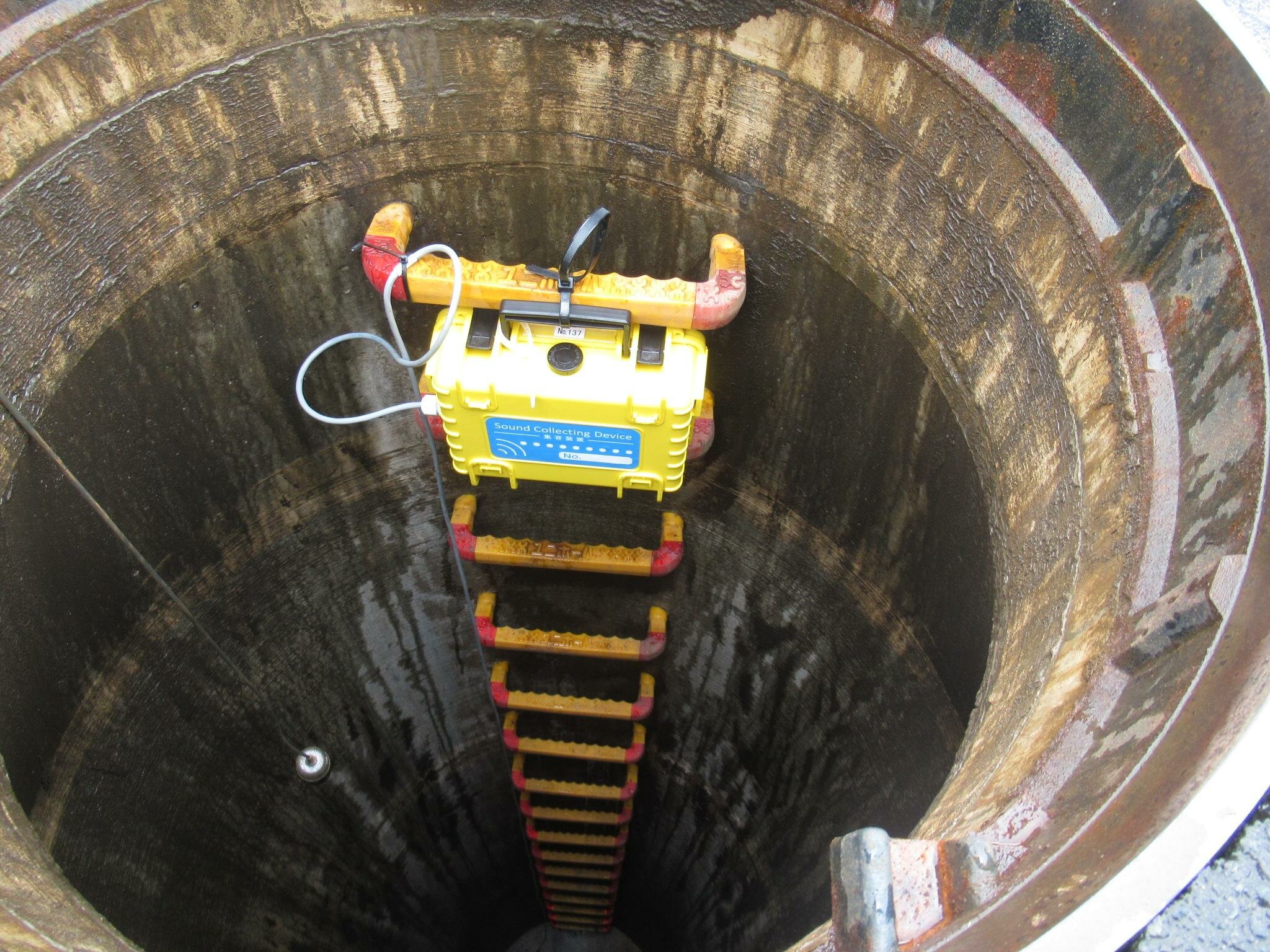
Development of a system to detect sewer infiltration/inflow during rainy weather
[Dramatic Cost and Time Savings] Patent: Development of a system to detect sewer infiltration/inflow during rainy weather Heavy rain can cause water to overflow from sewer systems. There are various causes for this. For example, if the sewer pipes have cracks or gaps due to aging, or if the manhole covers are damaged, infiltration/inflow* will enter the pipes during rainy weather, causing the phenomenon mentioned above. *Infiltration/inflow refers to water that enters the sanitary pipe of a separate sewer system during rainy weather, or water that enters a sanitary pipe buried below groundwater level. Neglecting water infiltration/inflow during rainy weather has many drawbacks. For example, more water entering the sewer than the system is designed to handle will result in flood damage and place a heavy load on the pumping stations. Furthermore, if sediment and deposits are drawn into the system together with the infiltration/inflow during rainy weather, it will lead to increased dredging and other maintenance costs for the sewer system. The higher volume of infiltration/inflow during rainy weather may also lead to an increase in costs borne by those living in affected municipalities. When the amount of water entering the sewage treatment plant increases due to infiltration/inflow during rainy weather, the cost of treating the sewage also increases, placing pressure on the operation of the sewerage system. Despite this, detecting sewer infiltration/inflow during rainy weather using conventional flow meters and water level gauges also requires expensive survey and analysis costs, and these costs limited the scope of surveyance. To address this situation, we have started to develop technology to detect infiltration/inflow during rainy weather quickly and inexpensively. Prediction and detection of infiltration/inflow during rainy weather using a machine learning model based on acoustic data In order to detect infiltration/inflow during rainy weather, we focused on acoustic data. Specifically, we use machine learning to model characteristic patterns of acoustic data containing the sounds of running water and/or the characteristic patterns extracted from acoustic data containing the sounds of running water under dry weather conditions and non-dry weather conditions. The system uses AI to predict and detect the presence or absence of water infiltration/inflow during rainy weather by comparing its results with actual observed data. After the introduction of this system, research and analysis costs were reduced by 50 percent compared to the conventional approach, and the use of AI also significantly shortened the analysis time. The results of our research on systems for sewage infiltration/inflow detection during rainy weather were evaluated by the Ministry of Land, Infrastructure, Transport and Tourism through a demonstration project, and we were also granted a patent evaluation. Patent number:Japanese Patent Application No. 2018-207773 Title of the invention:UNKNOWN WATER DETECTION DEVICE, UNKNOWN WATER DETECTION METHOD, PROGRAM, AND UNKNOWN WATER DETECTION SYSTEM *Joint patent with the National Institute of Advanced Industrial Science and Technology (AIST)
-
About the Logistics Research Group
We conduct research on logistics, which is especially crucial during disasters and pandemics, from the perspective of traffic planning and disaster prevention planning. In light of the importance and necessity of logistics, which is essential for urban and regional development as well as during disasters and pandemics, we hold regular research sessions to study traffic planning methodology and infrastructure and lifeline disaster prevention plans under the guidance of research advisor Hirohito Kuse (Professor Emeritus, Tokyo University of Marine Science and Technology). The main results of our research to date include the book Road Traffic Planning from the Perspective of Logistics published in February 2014 by Taisei-Shuppan Co., Ltd. (in Japanese only), which was written by our employees under the supervision of research advisor Kuse, and the multi-author column Road Traffic Planning from the Perspective of Logistics published in the Yuso Keizai newspaper in twelve installments from September 2015 to June 2016 (in Japanese only), which adds new knowledge to the book and is written in a relay format by research advisor Kuse and our employees. We also actively disseminate information on these research results through internal and public seminars and other means. The research group continues to tackle research to solve a variety of issues that are becoming increasingly serious.
-
Project to create new attractions in the Nihombashi area
Contributing to the community from the perspectives of civil engineering and urban development! Toward the creation of new attractions in Tokyo’s Nihombashi area *This was undertaken as our own research and no other institutions or organisations are involved. As a regular member of Nihonbashi Hamacho Area Management, CTI Engineering engages in community contribution activities from the perspectives of civil engineering and urban development in order to enhance the attractiveness of the Hamacho and Ningyocho areas, where our headquarters is located. For example, after analyzing the topographical and geological makeup of the area, we identified the unique aspects of the local landscape, studied technologies to restore the waterfront of the reclaimed Hamacho River, and proposed a concept for the Hamacho-Sumida River area based on technology such as super levees and applicable laws and regulations. The results were compiled into a booklet titled “Rediscovering the History and Culture of the Nihombashi Area (Hamacho and Ningyocho) and Creating New Attractions.” While the area around Nihombashi has come under the limelight due to recent news such as the undergrounding of the Metropolitan Expressway, there are still local resources and cultural elements that remain buried and are not widely known. By using CTI Engineering’s civil engineering and urban planning perspective to analyze how the profound history and culture of Nihombashi formed to reveal the area’s hidden charms, we continue to propose possibilities for the sustainable development of the Nihombashi area as an even more attractive district. Nihombashi Local Attractions Discovery Project In our 2018-2019 Study on the Characteristics of the Nihombashi Area, we created a chapter titled “Nihombashi Local Attractions Discovery Project,” through which we aimed to rediscover the charm of Nihombashi. ■Surveys and research to discover landscapes and tourist spots We examined the scenery of Nihombashi from various angles and ultimately narrowed it down to the “10 Best Views of Nihombashi.” Before this selection process, we evaluated the unique features of the Nihombashi area and identified views that exemplify the Nihombashi area. 1. Hamacho Park (Seishoko-ji Temple) 2. Suitengu Shrine 3. Seven Lucky Gods of Nihombashi (Koami Shrine and others) 4. Tornare (new public area for community interactions) 5. Hamacho Green Belt (pedestrian path built along the former Hamacho River) 6. Kiyosu Bridge 7. Townscape leading to Okannon-ji Temple 8. Kakigaracho Park (former Arima Residence) and Arima Elementary School (former reconstruction elementary school) 9. Meijiza Theater 10. Sumida River Promenade
-

R&D Investment Policy
Following the launch of the program in 1977, CTI Engineering Co., Ltd. has invested more than 900 million yen annually in research and development since the 2015 fiscal year.
More details -

Basic Policy on Intellectual Property
In order to ensure the effective use and proper management of important intellectual property, a medium- to long-term basic policy on intellectual property has been established.
More details -

BIM/CIM Initiatives
We introduce representative initiatives undertaken by CTI Engineering using BIM/CIM technologies.
More details